|
North Spain
The plan was to make the shortest voyage from La Rochelle to Northern Spain as possible, so it did not extend to more than a day/night/day. The other element was to avoid some of the gunnery range of the 'French Military' which extends several miles seawards from just south of Arcachon The planned outward leg on my C-Map Charts of the World system, was a day sail of some 50 miles to Royan - spend a night or so there then head out towards Hondaribbia which is on the Spanish frontier with Hendaye on the French Frontier across the river. The pilot books give the approaches to Hendaye as being shallow at low water and the entrance to Hondaribbia accessible at all tides and times. It is a brand new marina not mentioned in many guide books or on charts except the most recent one. I use the French Bloc Marine which is like Macmillan's with tide tables and harbour charts for everywhere from Dover to Coruna. Going into Arcachon is not really
an option as the entrance is very shallow, not lit at night
So there we were all ready for the first cruise of the season in our new boat to 'bravely go where others had been before'. Dawn in the Chalutiers basin of La Rochelle and around 10.00 the lock gates opened and we motored out across the bay towards the tip of Ile d'Oleron and began broad reaching in a northerly 3-4... lovely! Giving the shallows a wide berth round the lighthouse I turned south and we began to roll down wind towards Royan. All was going well despite the quartering swell which Robert and Roger who were sailing with us as far as Spain, found very uncomfortable. Louise who is never ill caught it from Roger then Robert and the next few hours were spent with the 3 of them sitting in the cockpit wishing they were anywhere else in the world, with occasional trips to the side of the boat to examine what mysteries lay below - or whatever!
Looking at the route on C-Maps Charts of the World and the paper chart, the 'southern' exit of the Gironde saved several miles and it appeared well marked.. HW was shortly after dawn and there was virtually no wind as we motored out Royan with just the mainsail up. The favourable tide and river current propelled us SW at a pace. I was really shocked to see so much disturbed water close to the markers and altered away from some very serious over-falls. This was the area where one of the ''Cockleshell Heroes'' canoes was lost shortly after they left the comparative safety of the submarine. We were there about an hour after high water, no wind to speak of and the breakers on the shallows were 2-3 metres high. There are no lights on any of the marks and I suspect the reason is that this passage should not be undertaken at night or when there is a significant wind over tide situation. In good conditions, with excellent visibility it's fine with the help of a chart plotter or C-Map charts of the world running on a laptop with a GPS dongle but otherwise the longer North entrance route is probably the way to go.
Since then I have been given the full details of how to find out about firings and often this news is only transmitted 24 hours before the event:- You can call on VHF 16 then move to VHF 06 or 10 to the 'Semaphores' SOCOA, MESSAGNES, CAP FERRET, POINT DE GRAVE (=Royan) or CHASSIRON (= la Rochelle) or you can call the CROSS ETEL (coastguard and speak English for certain!) by telephone on 0297 553 535..... The 'Range' also broadcasts lists of firings in 'French' at on VHF 6 & 10 Monday to Friday at 08.15 and 16.15 local time. You can also telephone the range and sometimes speak in English or listen to recordings in French and English on 0558 822 242 & 0558 822 243. Frankly your French needs to be pretty good for you to understand the VHF transmissions from the Semaphore stations so Cross Etel (coastguard) or telephone is the way to go... The marina offices will often help but given there is only 24 hours notice its not always good enough. Mainly they do not fire at weekends or during the main summer holidays as the 'instructors ' are on hols!!
Dawn and the French / Spanish frontier on the horizon and around 10.00hrs we entered the bay avoiding the rocks and shallows to the east... once inside the sails came down and the fenders out and we entered the canalised river and 'hung a right' into Spain and Hondarribia Marina. There is a small white buoy at the entrance which you may leave either side and once inside the fuel dock is off to the left and visitors pontoon straight ahead. You tie up there and go to the office to check in (with passports) and get moved to another berth if you are staying more than overnight. On your first visit you get 3 nights for the price of 2. It is a very secure and safe marina with excellent facilities. Be a bit careful parking as when at mid tide when its running fastest there is considerable current running... took me 4 attempts to get into a berth with the tide sweeping me off...
It was nice to be out of France
and into another country - Basque country - even the Parking Wardens and Town
Police wear the Red Beret of Basque Nationalists and road signs, as well as many
shop signs, are in the Basque language which is pretty impenetrable but with
Spanish translations underneath - a bit like Wales I suppose. Its a bit of a walk to the old
fisherman's town, about 10 minutes but once there its full of shops, restaurants
and small supermarkets. Interesting architecture
which is very different from neighbouring France and at the
I finding it very difficult to get the 'pick' to dig into the hard packed sand near to the fishing harbour which, I suspect, has rock underneath when we were shown to a mooring buoy beside the fishing harbour, by the 'club' boat and we took the dinghy to the visitors pontoon, tied up and spent the day site seeing. In the past I have successfully anchored behind the island but swinging room, with all the laid moorings around, is also a bit of a challenge. If you visit allow yourself the time to get to the next port in case it is impossible to find a berth for the night. Having said all that it is really worth a seeing St Sebastian. It is the summer capital of Spain. From June to September, the population swells as droves of Spanish bureaucrats head to this elegant resort to escape the heat. It is a bustling city with a population of 185,000 inhabitants, some 16,500 of whom are university students, being the cultural capital of the Basque country as well. There are some lovely little shopping streets and big squares to enjoy a quiet drink in the shade. Good shops and of course all the facilities of a major beach resort.
I really liked the place and was saddened when the marina manager said we had to leave as he had a fleet of boats from a 'rally' booked to come in and we would be in the way... 'Not a big problem as next
door is Zumaia with a new marina and they have plenty of The forecast was not good with a northerly F6-7 due in after 12 hours. I looked at my chart and decided I did not want to try Zumaia except an hour or so either side of high water, so decided to head onto Montrico which this years French Pilot Book reported as having already commenced building a new marina.... Mmmm... It was late in the afternoon when we sailed in past a new wall being built out of the cliff then an outer breakwater and through what felt like a very small gap into the inner harbour with not a sign of a pontoon or a marina at all - in fact just a more crowded version of the picture to the right! A fishing boat skipper indicated we should tie up against the wall and I went ashore to find the port captain to hopefully pick up a buoy in harbour.. He was really friendly but said with the bad weather coming in for the next few days they would probably all be wanted by their owners but I was welcome to lay against the wall beside the smart stainless ladder. He said he suspected we would be there for at least 3 nights until the 'blow' finished.
Back
aboard the books came out as I worked out the tidal range which appeared
to be around 6 metres so then a load of ropes were sent ashore as we practised
the art of 'loose moorings'. Despite my total confidence in my
mathematical ability I turned out towards low water to make sure we were not
being hung up from the cleats. All the fenders were out on the wall side
which was a good thing as despite the very narrow slightly overlapping entrance
a surge entered the harbour and made the night uncomfortable. The next day
was spent exploring the town and keeping an eye on the tide... A pleasant
enough place with some nice little bars and restaurants but with the worry of
at high water of having vast amounts of rope between her and the quay and
at low water surging against the 'pads' designed to keep steel ocean going
fishing boats off the wall it was not easy to relax and I decided that the
following morning we would leave for Bilbao - come hell or high water.....
Which is what we did!
An excellent 50 odd mile sail going really well. The headlands had some large swells coming into them so care was needed and as always when you depart, with front having gone through, the wind dropped all day and by afternoon we were motor-sailing our way into that huge and very secure port which is Bilbao and finding ourselves a berth in the friendly and welcoming Yacht Club of Marina Club Maritimo del Abra at Las Arenas. Unlike many Spanish Yacht clubs it positively encourages visitors and it has made shower facilities available just across the road from the marina in the main elegant club house. You are welcome in the little club house beside the marina to use their facilities when they are open but there is a dress code for eating and drinking beside the swimming pool and particularly in the main club house which is quite smart. Interestingly the 40€ a night fee plus extras for 'live aboard' reduced to 200€ all in for a two week stay. Bilbao is actually inland several miles up the river with low bridges in the vicinity of the town. It is therefore some miles from the town of La Arenas which has a wide range of good quality shops and grocery stores. There are a couple of bars who serve excellent tapas which makes lunch really easy, economic and delicious as well as having 'hot spots' for the internet. The 'metro' local train service
runs into Bilbao every few minutes and Louise and I thoroughly enjoyed Various commitments meant we had to leave the boat in Bilbao for a couple of weeks whilst we returned to Saujon France by hire car which worked out quite well - although I got a Spanish speeding ticket from a hidden radar. Quite expensive!!! The Club Maritimo were very helpful and made us feel confident she would be looked after and that was indeed the case. Robert re-joined Roger in their La Rochelle home then they left for England by air! On our return to Las Arenas, Louise and I encountered 3 boats that we had been friendly with in La Rochelle - in fact it looked like the Brits were taking over the small marina.. The winds had gone westerly and the prevailing current also headed east so we decided to start our return by heading for the port of Zumia where the tide would be towards high water at the end of the 50 mile sail. We paid the modest bill and set out a couple of days later. Lovely sail all the way and arrived more or less at HW more by luck than judgement. Looking at my depth meter and referring to the tide tables there does appear to be more water in the entrance canal than charted but with a 2 metre draft like ours I would not attempt it at more than the average half tide... but then I am very cautious..
There is a walk of about 10 minutes across the pedestrian bridge to the town but the nicest, best value restaurant, we found was actually within the marina complex. The onset of further bad weather gave us and extra couple of days here, which we thoroughly enjoyed in the lively town that has great tapas bars and a good atmosphere. Now somewhat delayed in our return trip we headed out across the corner of the bay to Bayonne in France which seemed to be the least tidal of the French ports in the South East corner of Biscay. In fact the marina is at Port d'Anglet - about a kilometre up the river just opposite the zone portuaire where the yellow road touches the river..... It was clearly accessible, except perhaps on the ebb tide when the current flows out at 5- 6 knots or more at big springs.... The pilot book also warns of surf in the entrance, over the bar in onshore winds over tide... this video shows the surf beside the entrance on a pretty calm day... Not sure I would use it as the first stop from La Rochelle or Royan although friends of ours have, very successfully. The early breakwater shot is of the pier to the north of the entrance and you can see ships anchored off waiting for the tide.... and a pilot... the rest is lots of surfers - about 100 metres from the entrance I think it is not a 'port of refuge' in anything of a blow...We timed the short passage to arrive just after low water and this was somewhat too early.. 3 hours before before HW would probably have been better but none the less, under motor power, we headed up the Adour river at a good 5-6 knots making perhaps 1-2 over the ground and taking avoiding action to miss the marker buoys of the drift nets that are set by the local fishermen 3/4 of the way across the river... It is important to keep to Starboard leaving the white marker buoys of the drift nets to port. What happens is the fishing boats - small launches - lay nets with the outside end on a large white buoy across the river some 2-300 metres above the marina entrance. Having dropped the net close to the south edge of the river they back off as close as possible to the North side then 'drift' with the current. Apparently they are supposed to leave enough space for boats to pass up or down stream on the south side... ' Supposed!' Still the south side is deep up to the shore line...Quite interesting! I radioed ahead to the marina control office and they asked me to call again when I was 5 minutes away. Off to port is a big industrial area with large coasters tied up charging and discharging cargo. It is noticeable that much of France, on the Atlantic coast, has considerable small ship activity all helping to keep large lorries off the roads I called up again on the VHF and was told there would be somebody on a pontoon to help us. We eventually came up to the narrow gap that had been created for the entrance to the marina and stemming the tide entered. It is not big and with some strong currents running I was please to see a couple of marina staff on a pontoon waiting to take our lines. With the current running strongly and not having a good angle on the berthing place I went astern and backed out into the river again, set up the lines and fenders and made a more direct approach to the berthing spot, which worked our fine as we were being pushed on by the not inconsiderable tide... Even if you French is not good it is probably worth making a call on Ch 9 to the office in case the visitors pontoon right in front of the office is occupied.
The last leg back to La Rochelle is almost always going to be to windward, except perhaps late in the season towards October. From the marina to the sea is about a mile, then you can draw a rum line on your 'charts of the world' from the breakwater to Point de Chassiron at the north end of the Ile D'Oleaon marking off a distance of 166 nautical miles. It passes the west side of the firing range and just north of that, passes the landfall buoy for the channel into the Gironde and the marinas there. It is going to be around 30 hours passing Royan channel after 24 hours with 50 miles still to go then another 3-4 hours when you reach the waypoint at Ile 'D'Oleaon into Les Minimes or La Rochelle. The problem with ducking out into Royan is that it requires you to use the channel at the flood tide and is going to be 3-4 hours to either Royan or one of the other Gironde harbours. Royan, after a night of motor-sailing with enough wind to make progress rather slow, at dawn and heard a weather forecast for a immanent Northerly F6. There were half a dozen ships waiting for the tide anchored in the area and we were sorely tempted to run into Royan so as not to have to bash to windward for 50 miles or so. In the end we decided to keep going and the wind backed WNW allowing us to have a sparkling windward sail all the way home to La Rochelle and made up for a night of motor sailing into a F3-4 with only the main just filling. Saujon October 2009
If you were interested in the above you might want to look at WEST COAST FRANCE which lists some of the marinas and ports we have visited. If you want to know more about La Rochelle/Les Minimes facilities then Sailing info la Rochelle
|
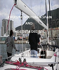
 In May of this year of 2009,
we
decided to make a short cruise to North Spain, on the southern Biscay coast, from my home port of
In May of this year of 2009,
we
decided to make a short cruise to North Spain, on the southern Biscay coast, from my home port of
 and can be rough in
any sort of wind over tide. I am not saying it cannot be entered but once
in all the constraints of high water and daylight hours make it a less than
great jumping off place.
and can be rough in
any sort of wind over tide. I am not saying it cannot be entered but once
in all the constraints of high water and daylight hours make it a less than
great jumping off place. Leaving
La Rochelle at high water more of less insures that you will be at the landfall
buoy off Royan and the approaches to the Gironde River towards low water.
Attempting the entrance without a flood tide requires considerable motor power
and is not really practical. You also need to be off Royan Marina well after LW
as the approach is only dredged to around 1.5mtrs. Every time I have been
into Gironde Estuary I have found it much more lumpy and demanding than I
expected and this was no exception. The currents made it difficult to
follow the channel and in fact I was several hundred metres outside it on one
occasion having been diverted by a wind shift and a need to reef. A couple
of hours saw us through the channel and heading into Royan where we tied up on
the fuel jetty for the night as the marina office closes at 18.00 and the
visitors pontoon was full. No real problem and in the morning we reported
to the marina staff then shifted to an empty berth nearby. Roger decided
that discretion was the better part of valour and jumped ship heading back to La
Rochelle by train. I was sad to see him go but the thought of more than 36
hours continuous sailing
was too horrible for him to contemplate... or undertake.
Leaving
La Rochelle at high water more of less insures that you will be at the landfall
buoy off Royan and the approaches to the Gironde River towards low water.
Attempting the entrance without a flood tide requires considerable motor power
and is not really practical. You also need to be off Royan Marina well after LW
as the approach is only dredged to around 1.5mtrs. Every time I have been
into Gironde Estuary I have found it much more lumpy and demanding than I
expected and this was no exception. The currents made it difficult to
follow the channel and in fact I was several hundred metres outside it on one
occasion having been diverted by a wind shift and a need to reef. A couple
of hours saw us through the channel and heading into Royan where we tied up on
the fuel jetty for the night as the marina office closes at 18.00 and the
visitors pontoon was full. No real problem and in the morning we reported
to the marina staff then shifted to an empty berth nearby. Roger decided
that discretion was the better part of valour and jumped ship heading back to La
Rochelle by train. I was sad to see him go but the thought of more than 36
hours continuous sailing
was too horrible for him to contemplate... or undertake.

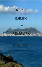
 Having
cleared the Estuary I set course for Hondarribia which is the very first Spanish
port on the frontier with France whose port is Hendaye. The advantage of
Hondarribia is that there is deep water all the way in, gasoil - diesel is
cheaper than France and it means taking down the French courtesy flag and
hoisting the Spanish flag! The frontier between Spain and France is in the
middle of the river Bidasoa which flows into the Txingudi Bay. This took us
through the Gunnery Range area. Royan marina had informed us the day
before that no firings information had been sent to them.... Listening to
the weather forecasts on the French VHF as we sailed south I became aware that a
list of coordinates for an exclusion zone were being promulgated.
There were two zones almost adjacent from the coast to some 8 miles out and both
were to become active at 10.00 local time but transmitted in Universal Time so
some counting on fingers was required! Having plotted my position and
course and assuming we made about 6 knots it looked to me as if we would clear
the danger area around 08.00.
Having
cleared the Estuary I set course for Hondarribia which is the very first Spanish
port on the frontier with France whose port is Hendaye. The advantage of
Hondarribia is that there is deep water all the way in, gasoil - diesel is
cheaper than France and it means taking down the French courtesy flag and
hoisting the Spanish flag! The frontier between Spain and France is in the
middle of the river Bidasoa which flows into the Txingudi Bay. This took us
through the Gunnery Range area. Royan marina had informed us the day
before that no firings information had been sent to them.... Listening to
the weather forecasts on the French VHF as we sailed south I became aware that a
list of coordinates for an exclusion zone were being promulgated.
There were two zones almost adjacent from the coast to some 8 miles out and both
were to become active at 10.00 local time but transmitted in Universal Time so
some counting on fingers was required! Having plotted my position and
course and assuming we made about 6 knots it looked to me as if we would clear
the danger area around 08.00.
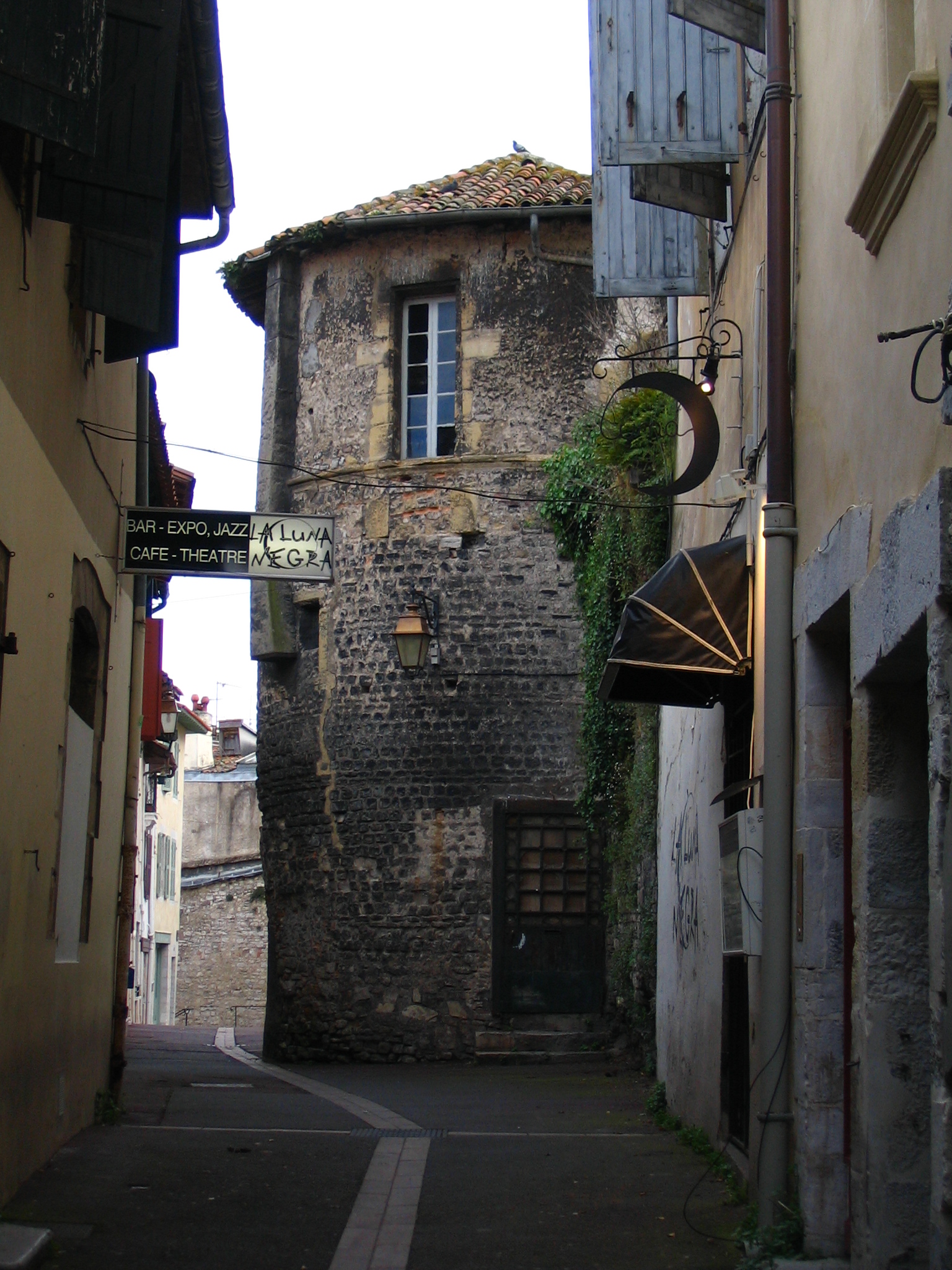
 far end
of the town an excellent small tourist office. Just
beyond the town is the 'Old Town' - a bit of a walk but very well worth it.
The old castle at the top has been converted into a Parador Hotel - A chain of
state owned luxury hotels and the walk though the cobbled streets is delightful.
Dominating the town from its highest point, the Parador rises up in the
beautiful Plaza de Armas next to the Nuestra Señora del Manzano church, in the
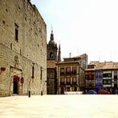
old quarter of one of the most stately towns of the Basque Country. Hondarribia
(formerly Fuenterrabia) - all a bit like something out of Kiss me Kate!
Worth going into the lobby and there are nice bars on the other side of the
square for sitting out drinking cold beer, coffee or chocolate.
far end
of the town an excellent small tourist office. Just
beyond the town is the 'Old Town' - a bit of a walk but very well worth it.
The old castle at the top has been converted into a Parador Hotel - A chain of
state owned luxury hotels and the walk though the cobbled streets is delightful.
Dominating the town from its highest point, the Parador rises up in the
beautiful Plaza de Armas next to the Nuestra Señora del Manzano church, in the
old quarter of one of the most stately towns of the Basque Country. Hondarribia
(formerly Fuenterrabia) - all a bit like something out of Kiss me Kate!
Worth going into the lobby and there are nice bars on the other side of the
square for sitting out drinking cold beer, coffee or chocolate. Just
a couple of hours sail down the coast is the idyllic town bay of St Sebastian
which sadly, except in winter, is never an empty anchorage as shown in the
picture on the right! The entrance which looks so clear and calm, is
apparently is full of white water and unusable in gales. Once inside to
the east (left just past the aquarium) is the little fishing harbour and the
yacht club with moorings laid everywhere. To the west, behind the island, are
more moorings with the possibility of finding a place to anchor, except it is
then a long dinghy ride to the little fishing harbour and the dinghy pontoon.
Smaller yachts may be able to enter the little harbour and find a space on the
pontoons or possibly pick up a buoy if it is vacant and then check with the
'club'.
Just
a couple of hours sail down the coast is the idyllic town bay of St Sebastian
which sadly, except in winter, is never an empty anchorage as shown in the
picture on the right! The entrance which looks so clear and calm, is
apparently is full of white water and unusable in gales. Once inside to
the east (left just past the aquarium) is the little fishing harbour and the
yacht club with moorings laid everywhere. To the west, behind the island, are
more moorings with the possibility of finding a place to anchor, except it is
then a long dinghy ride to the little fishing harbour and the dinghy pontoon.
Smaller yachts may be able to enter the little harbour and find a space on the
pontoons or possibly pick up a buoy if it is vacant and then check with the
'club'.  The
next morning we headed out of the bay for a pleasant sail westwards to Guetaria
which can be entered at any state of the tide. Basically a fishing village/town
it has a small marina just to port as you enter, with all facilities. The
town itself Getaria (Guetaria, in Spanish), is known as
la cocina de guipúzcoa, the kitchen of Guipúzcoa province, for its
many restaurants and taverns. Getaria was the birthplace of Juan Sebastián
Elcano (1460-1526), the first circumnavigator of the globe and Spain's most
emblematic naval hero. Elcano took over and completed Magellan's voyage after
the latter was killed in the Philippines in 1521. The town's galleon like
church has sloping wooden floors resembling a ship's deck. It has several
steep streets leading up to the square and one of the cafe's has a 'hot spot' so
you can enjoy a quiet drink and some tapas whilst you get online..
The
next morning we headed out of the bay for a pleasant sail westwards to Guetaria
which can be entered at any state of the tide. Basically a fishing village/town
it has a small marina just to port as you enter, with all facilities. The
town itself Getaria (Guetaria, in Spanish), is known as
la cocina de guipúzcoa, the kitchen of Guipúzcoa province, for its
many restaurants and taverns. Getaria was the birthplace of Juan Sebastián
Elcano (1460-1526), the first circumnavigator of the globe and Spain's most
emblematic naval hero. Elcano took over and completed Magellan's voyage after
the latter was killed in the Philippines in 1521. The town's galleon like
church has sloping wooden floors resembling a ship's deck. It has several
steep streets leading up to the square and one of the cafe's has a 'hot spot' so
you can enjoy a quiet drink and some tapas whilst you get online..  space always' -